Most people purchase iBobbers for fishing, affordability, user-friendliness, the convenience of its small castable size, and Bluetooth Smart Technology. But when you buy something, you want to get your money’s worth, so we encourage people to be creative with how they use their iBobbers.

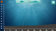
Let’s look at the Waterbed Mapping feature on the iBobber app as an example. By casting and reeling in your iBobber, you can use your smartphone to see the water depths, structures, and vegetation along a lake or riverbed, which can help you decide where to fish, place fish traps, and what lures to use. But this ability to visualize a waterbed can have plenty of other practical applications for water-based sports, boating, scuba diving, and even biological or historical research.
We’ve rounded up a few of our favorite non-fishing applications for the Waterbed Mapping Feature, and we would love to hear your suggestions on our Facebook and Twitter pages:
1) Locating reefs for scuba diving

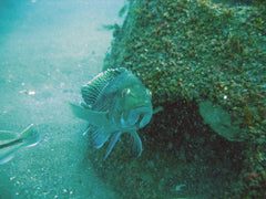
I wish I had known about the iBobber when I was conducting my masters’ thesis research on artificial reefs in Charleston. If you haven’t gone diving before, the artificial reefs in South Carolina are a far cry from the crystal-clear waters and shallow reefs in the Caribbean. We would dive at depths of 60’ or greater, and depending on the time of year, visibility would be 10-15’ on a good day. Our research vessels were equipped with depth sounders, so we would know when we were on top of the reefs. But we had plenty of days where choppy waters would push our boats, since we didn't risk dropping an anchor on the reefs, so we would still have to search for the sites once we were underwater. And at depths of 60', we would have less than half an hour to find the reef, collect our data, and return to the surface safely.
The iBobber projects sonar up to 135’ in depth and 100’ from your smartphone, and it handles saltwater like a champ. For these reasons, the iBobber would make an affordable, easy-to-use supplement to any scuba diving operation that frequently contends with choppy water and deeper dive sites that you can’t see from the surface.
2) Teaching the basics of fisheries management
 As both a fisheries biologist and avid sport angler, I realize the importance of understanding why we manage recreationally valuable fish species. The iBobber is user-friendly and affordable enough that teachers with an interest in biology or fisheries could easily incorporate the sonar and waterbed features into their lessons to help students apply what they learn in the classroom to the real world. Now I’m on the other side of academia as a part-time biology professor, and I love brainstorming unique ways to get college students excited about science. If I ever had the opportunity to teach a more advanced class on aquatic biology or fisheries, I would take the students out to the nearest lake or other body of water and show them through the iBobber Sonar and Waterbed mapping how fish tend to congregate around structures, such as man-made fish attractants as well as natural formations.
3) Teaching children about boating safety
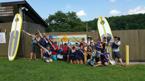
My fiancé teaches boating camps during the summer to middle schoolers, and the first thing they learn is the importance of wearing life jackets. But kids at that age still often think they’re invincible, and some of them may not realize how the water levels in a lake can drop abruptly from 5-10’ near the shore all the way to 100’ or greater in some places.

Naturalists, boat safety officers, Boy/Girl Scout leaders, or anyone who teaches boating safety can use the Waterbed features on the iBobber to give students a clear visual of how water depth can quickly change on a lake to reinforce the importance of wearing life jackets and good boating safety practices.
4) Scouting unfamiliar waters while boating
Boating safety isn’t just for children. Whether you use a motorboat, sailboat, or a kayak, sooner or later you’re going to encounter unfamiliar stretches of water where it may be hard to see the bottom. You don’t want your expensive motorboat to accidentally run aground while trolling in an unfamiliar cove where the waterbed suddenly becomes too shallow. For those reasons, people typically equip their boats with sonar and fishfinders that project downward to see what lies directly below them.
However, the castable iBobber can provide advanced notice of sudden changes to the waterbed before you’re directly on top of something, and if you’re in a kayak without any of the typical motorboat electronics, sometimes those few yards can prevent you from paddling across a submerged obstacle and possibly damaging your boat.
5) Locating submerged historical sites and ruins

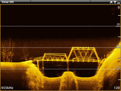
History buffs, this one is for you. Every man-made lake has a unique story to tell about how and why it was created. For instance, I kayak on Tims Ford Lake in Winchester, Tennessee regularly, and the Tennessee Valley Authority created the lake for recreation over the lands of a former community called Marble Plains. Some of original structures and buildings from the community are still relatively intact at the bottom of the lake, and boaters have taken sonar images of old submerged bridges, building foundations, and even an old power generator. Any state or national parks with man-made lakes could replicate these findings with the iBobber and incorporate them into programs for park visitors to educate them on the history of their public lands.
So what do you think about our unconventional uses for the iBobber? How many of these have you already used? If you have come up with some creative applications for the Waterbed Mapping or any other feature on the iBobber, then we would love to hear your thoughts on our Facebook and Twitter (@ReelSonar) pages!

